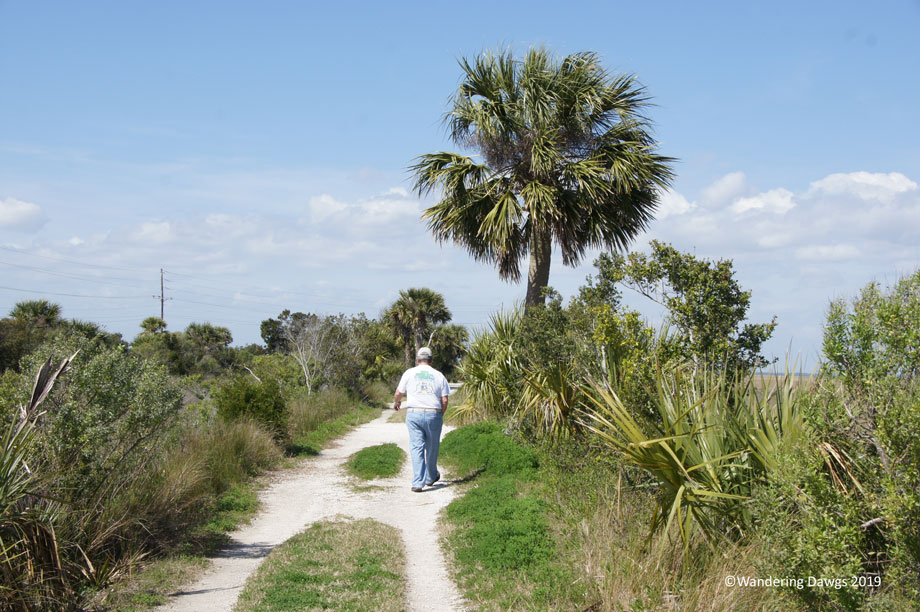
The Rails-to-Trails Conservancy nonprofit organization has created a nationwide network of trails from former rail lines. The McQueen’s – Tybee Island Trail near Savannah, Georgia is one of the those trails. The gravel trail is a popular place for walking, biking and jogging.
The trail suffered extensive damage in 2016 when Hurricane Matthew came through the area in October. Less that a year later, Hurricane Irma caused more damage. The work to repair the damage is still not complete and parts of trail are closed.
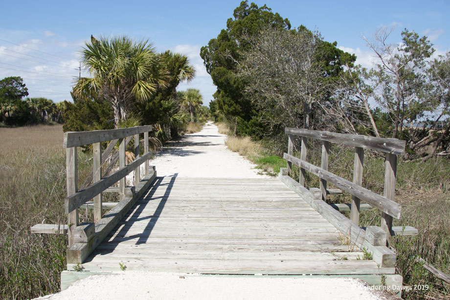
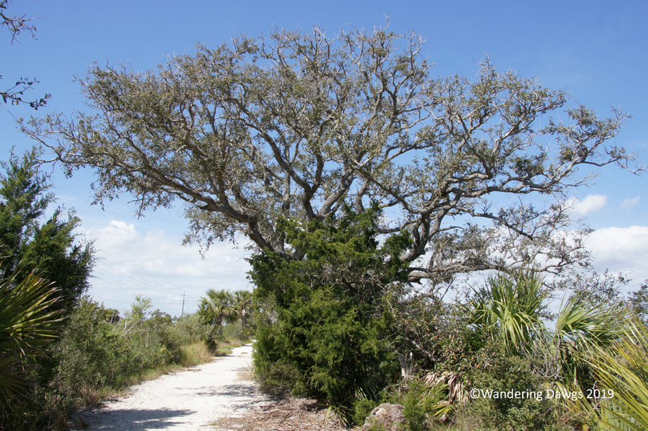
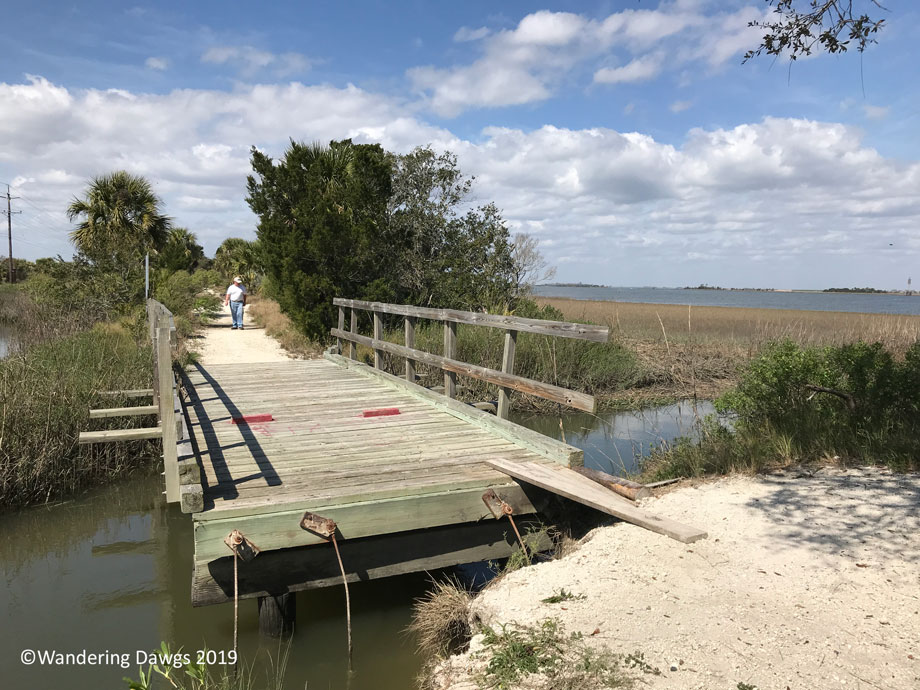
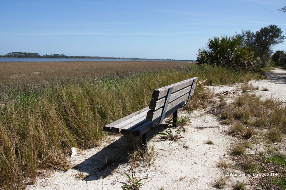
As of now, the only access to the trail is a parking area at the trailhead near the entrance to Fort Pulaski National Monument. Starting at the trailhead, we walked until we came to a damaged bridge that still can be crossed safely. In all we went about about a mile and a half round trip.
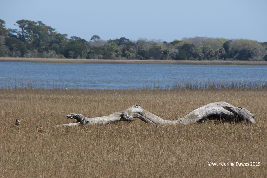
The bridge to Fort Pulaski National Monument as seen from McQueens – Tybee Island Rails To Trails, Savannah, GAMcQueens – Tybee Island Rails To Trails, Savannah, GAMcQueens – Tybee Island Rails To Trails, Savannah, GAMcQueens – Tybee Island Rails To Trails, Savannah, GAThis bridge was damaged during one of the storms that went through the areaA great place to sit and enjoy the viewDriftwood in the salt marsh beside the trail
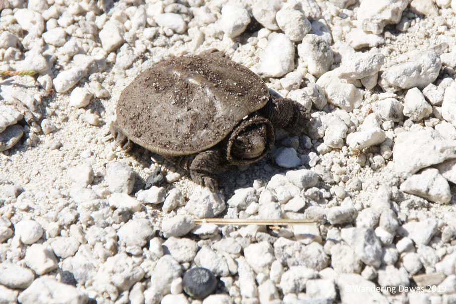
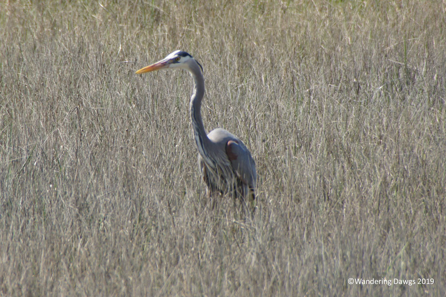
We spied some wildlife along the trail.
This little diamond back terrapin was crossing the trail in front of usGreat blue heron in the salt marsh beside the trail
It was a gorgeous March day to get out and explore close to home.
After our four hectic days in Daytona we enjoyed a relaxing week at Silver Springs State Park. Up until the last day the weather was perfect for getting out and exploring the park.
There are two entrances to the state park. The main entrance (also called the historic entrance), on highway 40, is the location of the world famous glass bottom boat tours, a boardwalk trail, kayak and canoe launch and rental, a restaurant, meeting rooms, and paved trails on the beautifully landscaped grounds. The other entrance, on highway 35, leads to the campground, several hiking and biking trails, a day use area, The Silver River Museum, and a cracker village.
A trailhead next to the Silver River Museum is the starting place for the swamp trail and the river trail. We chose to explore the swamp trail first. This two mile loop trail took us through a lush tropical forest before crossing a boardwalk over the swamp. At the end of the trail is an overlook on the Silver River.
Swamp Trail, Silver Springs State ParkSwamp Trail, Silver Springs State ParkSwamp Trail, Silver Springs State ParkSilver River from the Swamp Trail Overlook, Silver Springs State Park
Another day we walked on the river trail to a different overlook on the Silver River. We returned by way of the river field loop which meanders along the Silver River before meeting back up with the main trail.
River Trail, Silver Springs State ParkThe Silver river at the end of the river trailA group of paddlers took a break at the river trail overlookPickerel Weed in the Silver RiverOsprey beside the Silver River
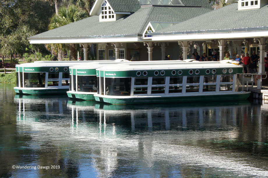
We chose to drive to the main entrance instead of taking the 2 1/2 mile walking and biking trail. From the Ross Allen Boardwalk Trail we could watch the kayakers paddling out to Silver River. From the paved paths beside the springs we were able to look down into the crystal clear water. We continued along the path next to the river and stopped at another overlook before following the path beside gardens blooming with azaleas.
Ross Allen Boardwalk Trail, Silver Springs State ParkSilver Springs State ParkGlass Bottom Boat at Silver Springs State ParkStepping Stones at Silver Springs State ParkCorkscrew tree at Silver Springs State ParkSea Hunt overlook at Silver Springs State ParkSilver Springs State ParkSilver Springs State Park
One day we drove about 30 minutes to Juniper Springs Recreation Area for a swim and a picnic. Swimming in the 72 degree water was a great way to cool off on a warm day.
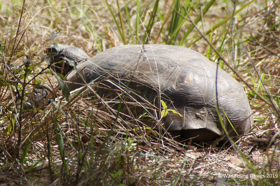
Relaxing at the campsite one day, we spied this gopher tortoise munching on the grass.
Gopher Tortoise, Silver Springs State Park
On Saturday morning, the Friends of Silver River State Park had a pancake breakfast to raise funds for their organization. After breakfast we took a tour of the cracker village, a replica of a 19th century settlement, and the Silver River Museum. The term “cracker” refers to the people who settled in Florida.
Church and Schoolhouse, Cracker Village, Silver Springs State ParkCracker Village, Silver Springs State ParkKiln, Cracker Village, Silver Springs State Park
The Silver River Museum and Environmental Education Center is a program of Marion County Public Schools. During the week, the museum is closed to the public while school children are attending classes. On some weekends, the museum is open to the public. The well done exhibits cover the history of the area from prehistoric days to the present.
We had planned to rent a canoe and paddle on the Silver River on our last day but we changed our plans when cold weather moved in. On our visit last year we took a glass bottom boat tour so we decided to skip it this year.
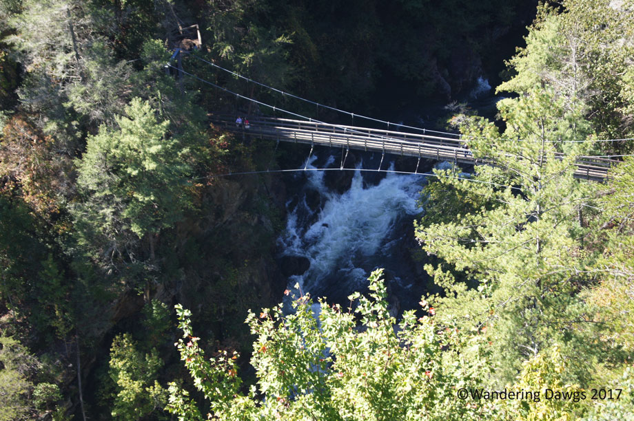
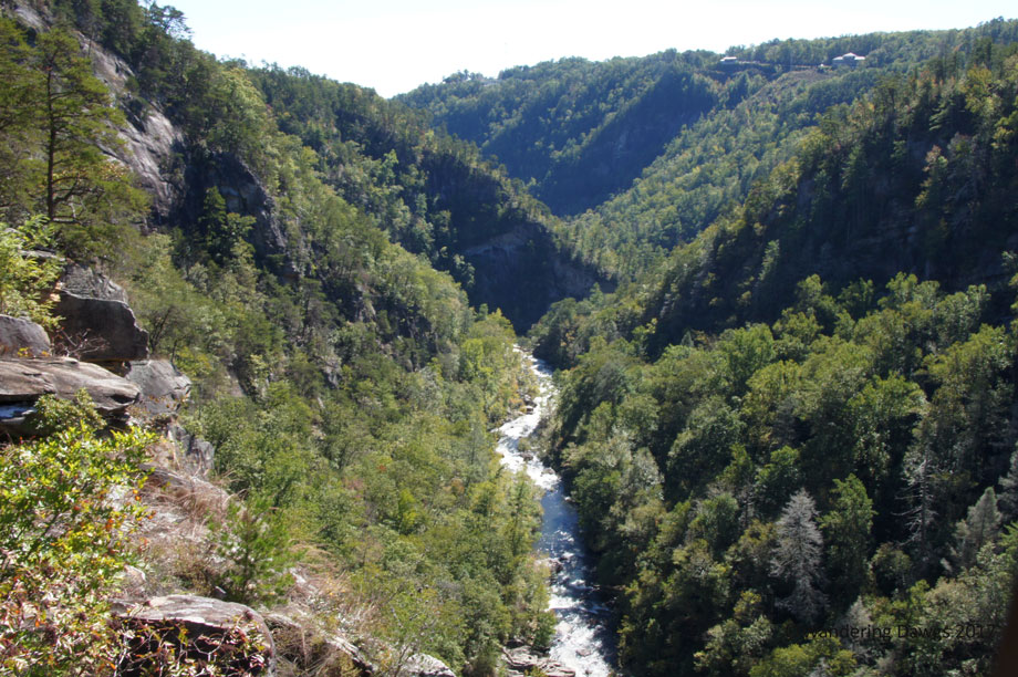
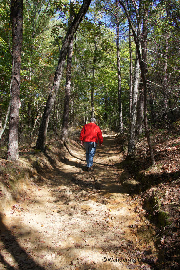
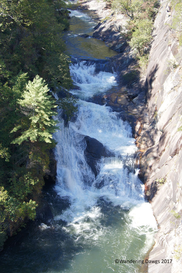
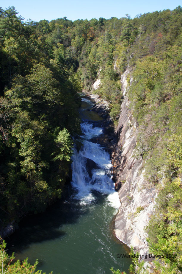
The almost 1,000 foot deep Tallulah Gorge is a spectacular place in the Georgia mountains for hiking and seeing waterfalls. The hiking trails range from easily accessible rim trails with overlooks of the gorge to a strenuous hike to the gorge floor requiring a permit. After entering the state park we went straight to the Visitor’s Center for a trail map before beginning our trek on the North Rim trail. We stopped at two overlooks with views of the gorge.
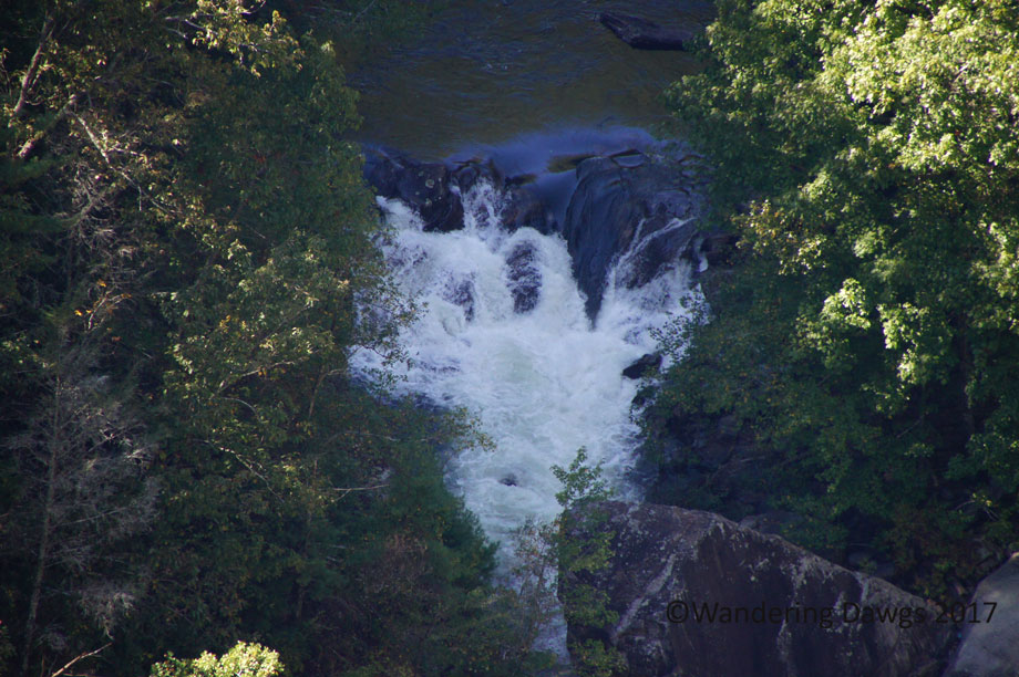
Looking down at the suspension bridge above Hurricane Falls
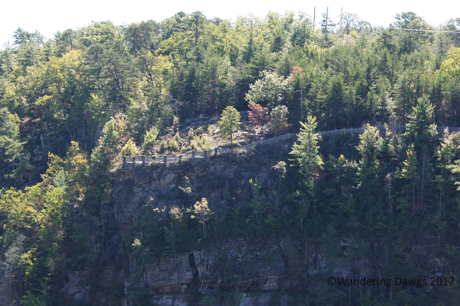
An overlook on the south rim trail on the other side of Tallulah Gorge
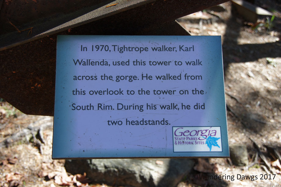
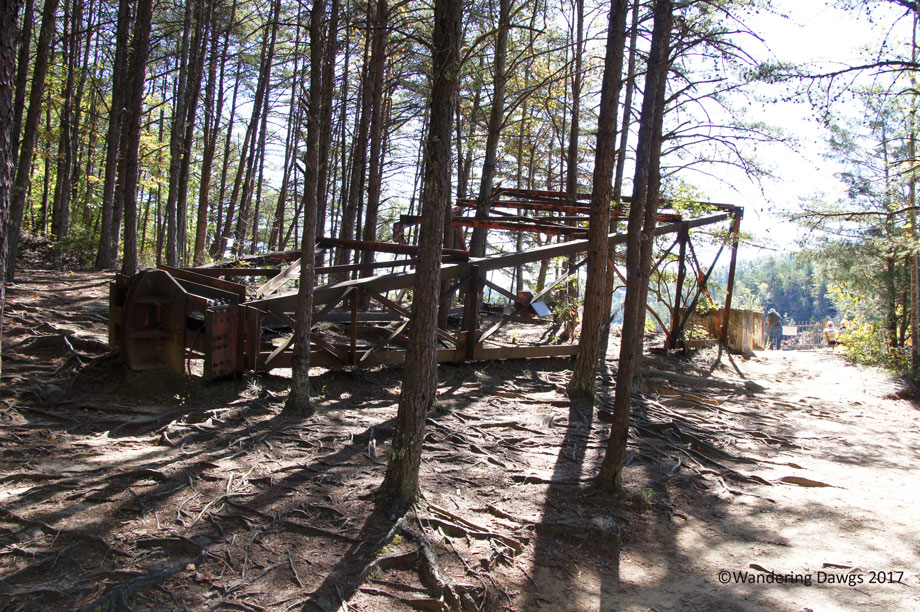
On July 18, 1970, tightrope walker Karl Wallenda walked across the gorge from this overlook on the north rim to the south rim.
Tightrope walker Karl Wallenda walked a tightrope across the gorge
Wallenda Tower used by Karl Wallenda in his tightrope walk across the gorge in 1970
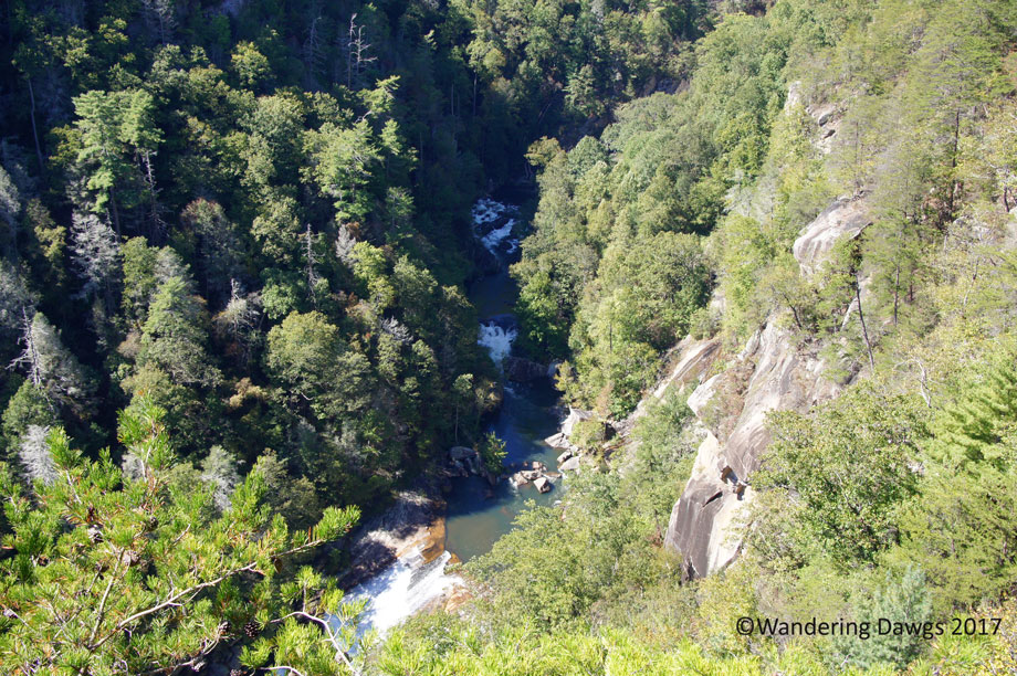
The Tallulah river at the bottom of Tallulah Gorge
View from one of the North Rim overlooks at Tallulah Gorge State Park
Inspiration Point is the highest point in the park and the trail to get there was was a quarter mile uphill hike. When we got to the top we were happy we decided to do the trail.
On the trail to Inspiration Point
One of the waterfalls as seen from Inspiration Point
View from Inspiration Point
View from Inspiration Point
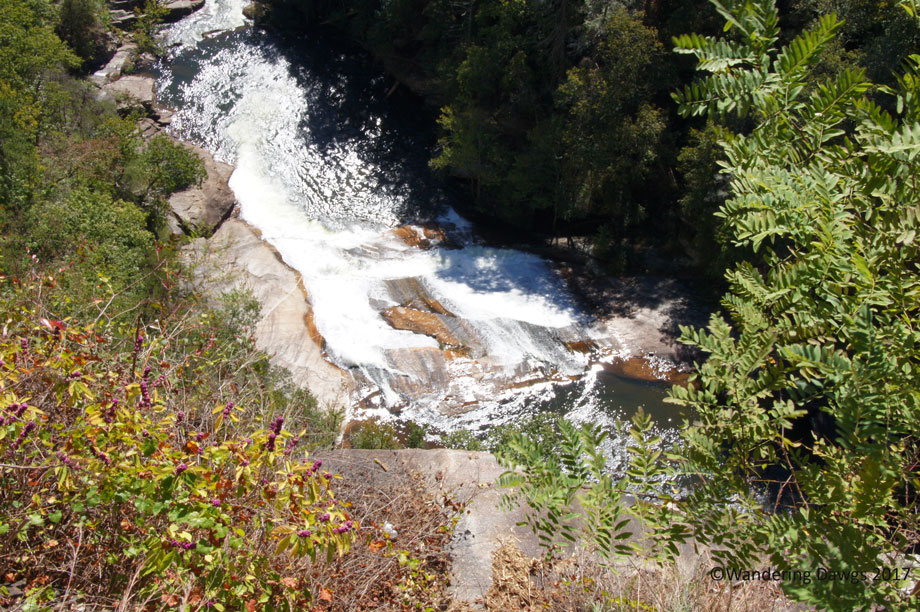
The good news was it was downhill to return to the North Rim Trail from Inspiration Point. With more waterfalls to see we continued along the north rim to two more overlooks.
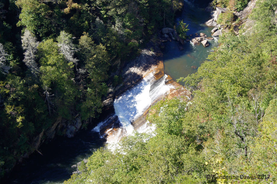
L’Eau d’Or Falls in Tallulah Gorge
L’Eau d’Or Falls in Tallulah Gorge
It was way past lunchtime by then so our last adventure at Tallulah Gorge would have to wait until the next morning. It was time to head back to Dillard for some delicious southern cooking at the Dillard House.
The Dillard House
The Dillard House
Dillard House dining Room
Bring your appetite when you go to The Dillard House
After our late lunch we were done for the day. Stay tuned for our final adventure at Tallulah Gorge.
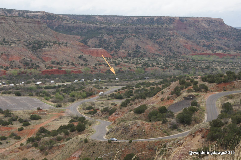
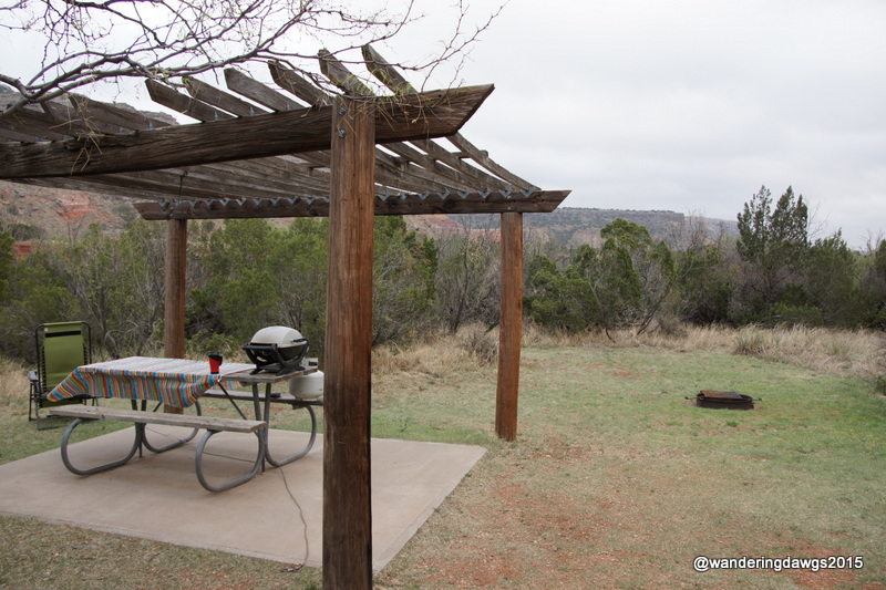
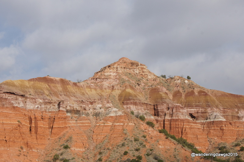
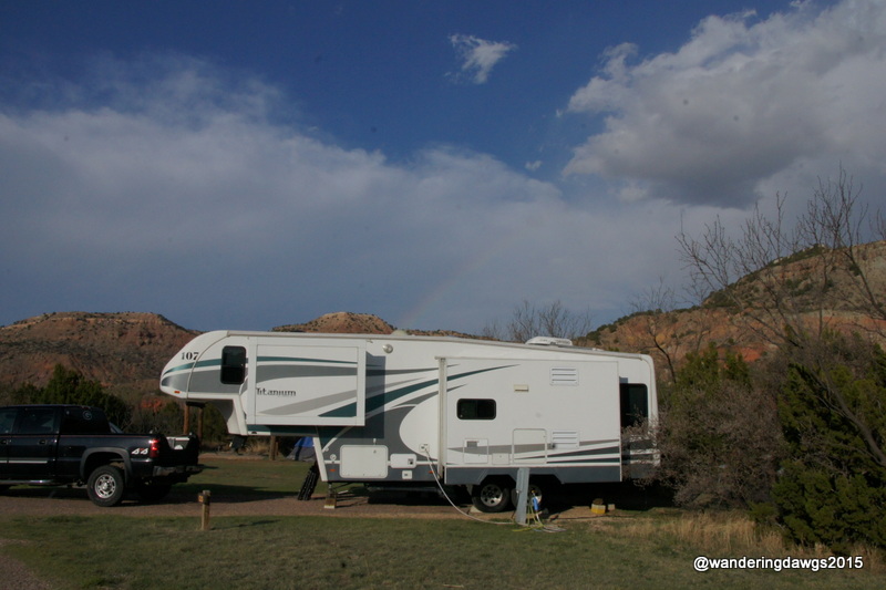
I was really looking forward to camping in Palo Duro Canyon. Just the idea of looking up at the canyon walls from our campsite was enough to plan our trip around a stay in the park. It was worth the two mile drive into Palo Duro Canyon down several switchbacks and a 10% grade to get to one of our most memorable campsites in all of our camping years. Our site in the Sagebrush campground had great views of the canyon and a private little sitting area behind our RV.
Our private picnic area behind the RV
Known as the Grand Canyon of Texas, Palo Duro Canyon is the second largest canyon in the United States. With 16 miles of paved roads through the canyon and miles of hiking, biking, and horse trails, there is enough to make everyone happy.
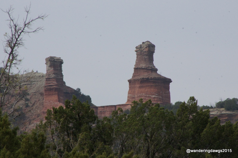
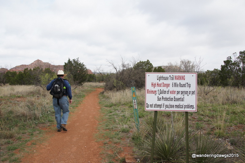
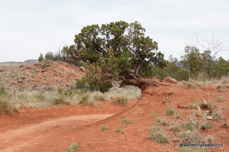
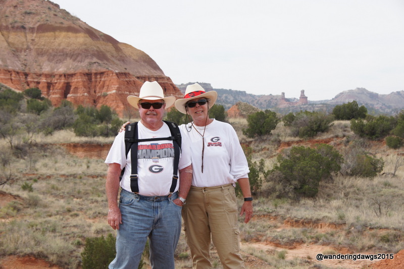
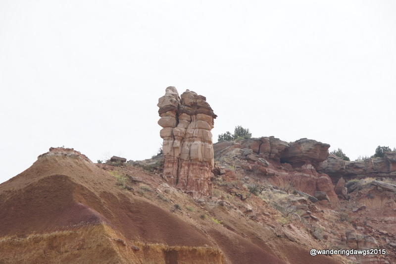
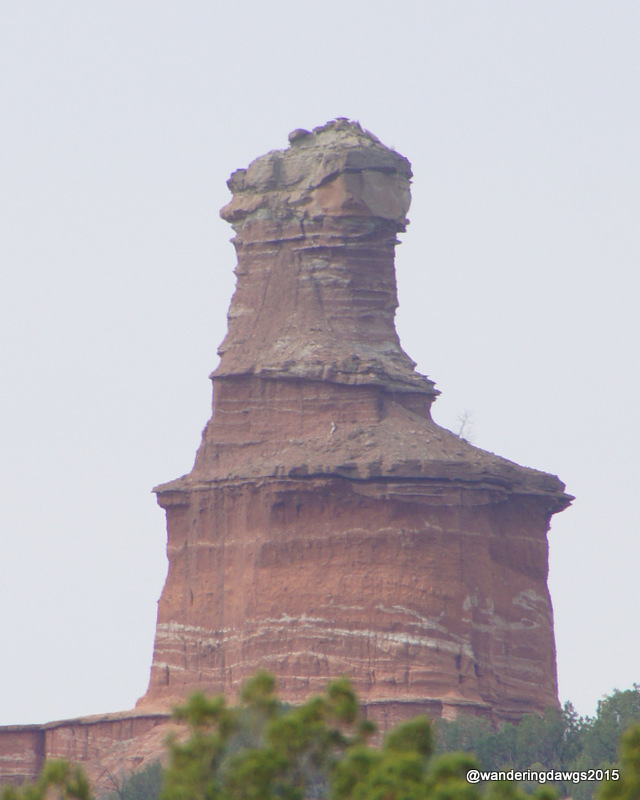
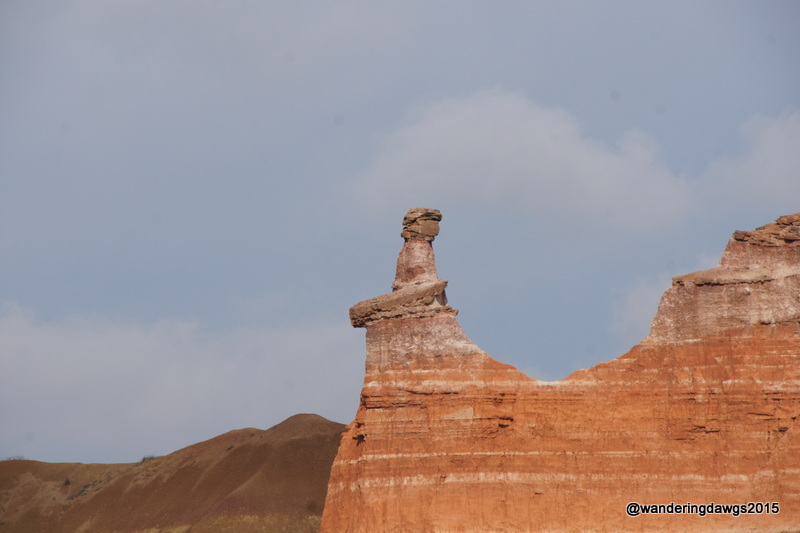
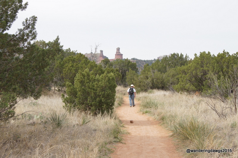
One of the most popular trails in the park is the Lighthouse Trail through the canyon for a close up look at the Lighthouse formation, the symbol of the state park. The multi-use trail is about a 6 mile round trip from the parking lot. We started out early on a cool Sunday morning and encountered cyclists, runners, and other hikers but no horses along the trail. A transplanted Georgian who now lives in Amarillo stopped to chat as we passed each other on the trail.
View from the Lighthouse Trail
The trail was packed red dirt and rock but not difficult. Our plan was to go to the base of the lighthouse but when two different hikers stopped to tell us about two rattlesnakes ahead of us I was done. Henry went a little farther and tried to convince me there was no sign of them but I wouldn’t budge! I was tired and ready to head back so we turned around about .2 miles before the end of the trail. We were done for the day when we got back to the campsite and loafed the rest of the afternoon.
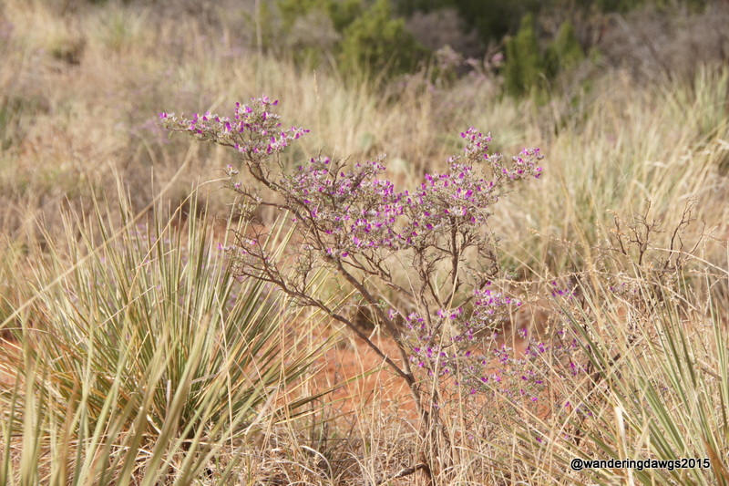
Starting the Lighthouse TrailAlong the Lighthouse TrailJuniper on the trailIs this a purple sage beside the trail?Our first view of the lighthouse from the trailHoodoo on the Lighthouse TrailThe LighthouseHoodoo on the Lighthouse TrailHenry searching for rattlesnakes on the trail
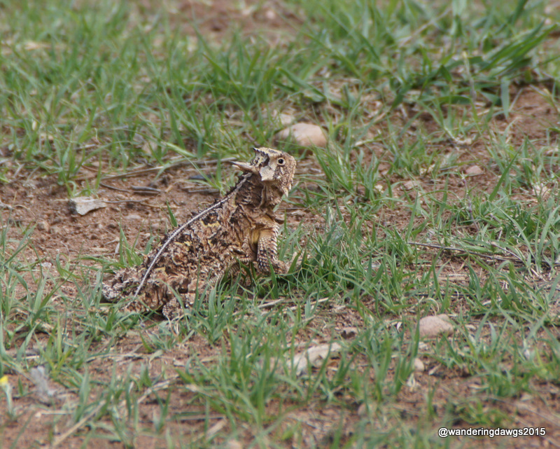
Although there was no wildlife along the trail (except for the rattlesnakes we didn’t see) there was plenty of wildlife in the park. On the first afternoon I spotted a threatened Texas Horned Lizard in our campsite.
This Texas Horned Lizard ran through our campsite
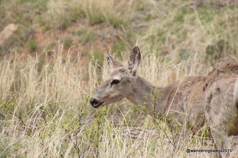
This Mule Deer beside the road wasn’t afraid of me.
Mule Deer
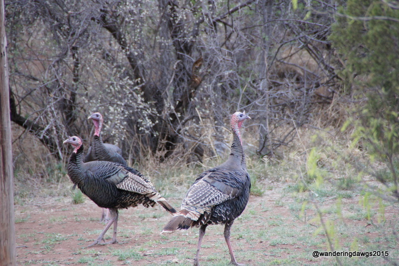
Wild Turkeys wandered through the campground one evening.
Wild Turkeys wandered through the campground
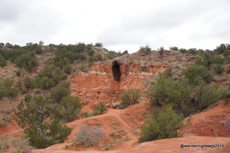
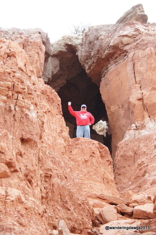
We took a short hike to explore the Hole In the Wall.
Hole in the WallHenry climbed up to explore while Blondie and I waited below
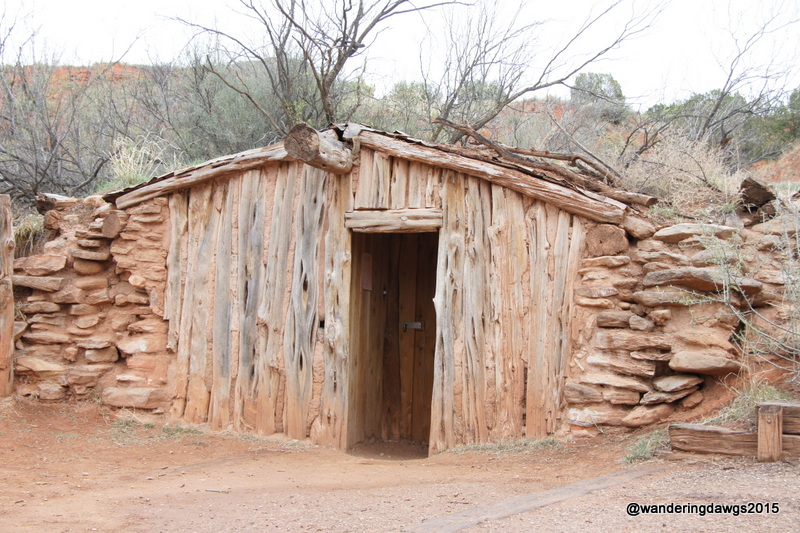
And explored the replica of a Cowboy Dugout.
Cowboy Dugout
There was a rainbow one afternoon.
Rainbow after a short rain shower
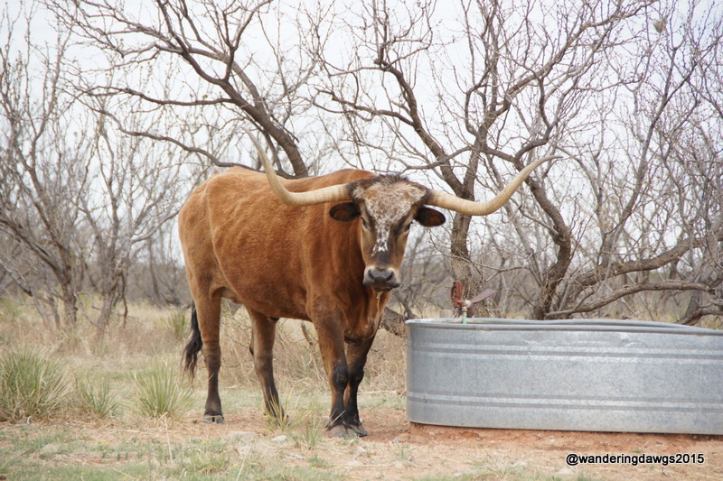
We saw T-Bone, one of the resident Texas Longhorns in the park.
T-Bone, one of the Texas Longhorns
We enjoyed our stay so much I think this is now my favorite state park!
There are several campgrounds in Palo Duro Canyon State Park with backpacking, equestrian sites, tent sites, and RV sites with water and electricity.Our site in the Sagebrush Campground had large private sitting area with a covered shelter over the picnic table and a fire ring. There are hiking, biking and equestrian trails. There are also several day use picnic areas, cabins, stables with guided horseback rides, an interpretive center, and the Trading Post Restaurant and Park store. If you would like to read my detailed campground review of this park, click here.
We weren’t ready to leave the Texas Hill country just yet. With Inks Lake full for Easter weekend we had to vacate our lake front campsite and find another place to stay. We really liked the town of Llano and found a private RV park beside the Llano river that had a site for the three nights.
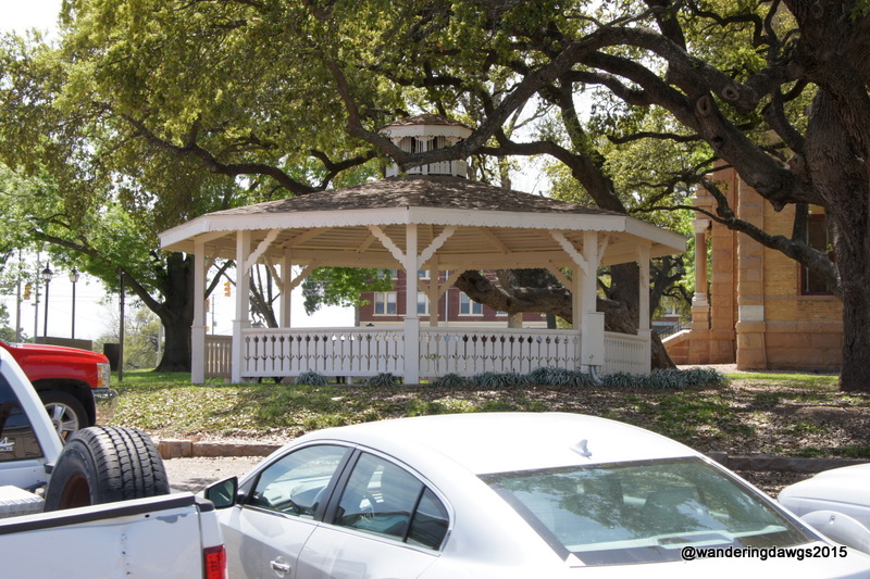
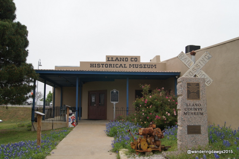
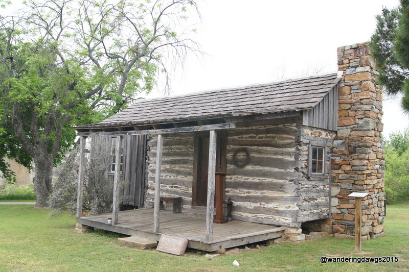
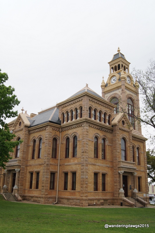
Llano River Bridge in LlanoGazebo in Llano, TexasLlano Train DepotLlano MuseumThe old cabin was moved to the Llano MuseumLlano Courthouse
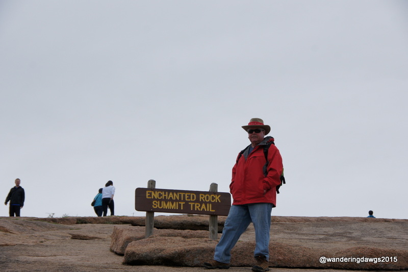
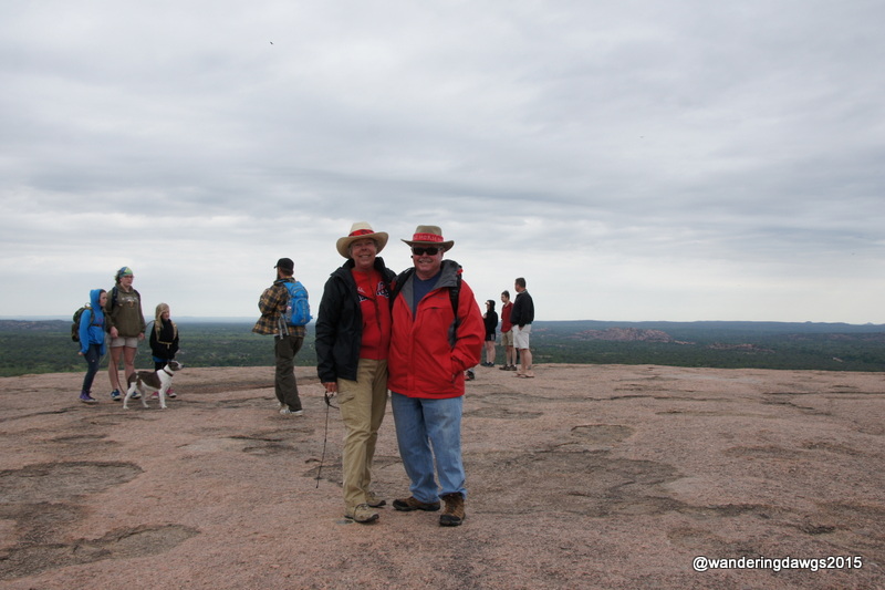
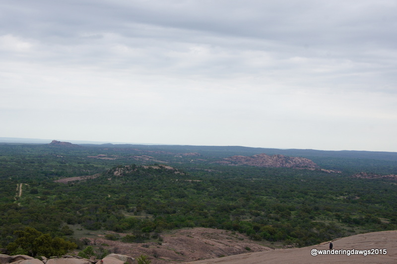
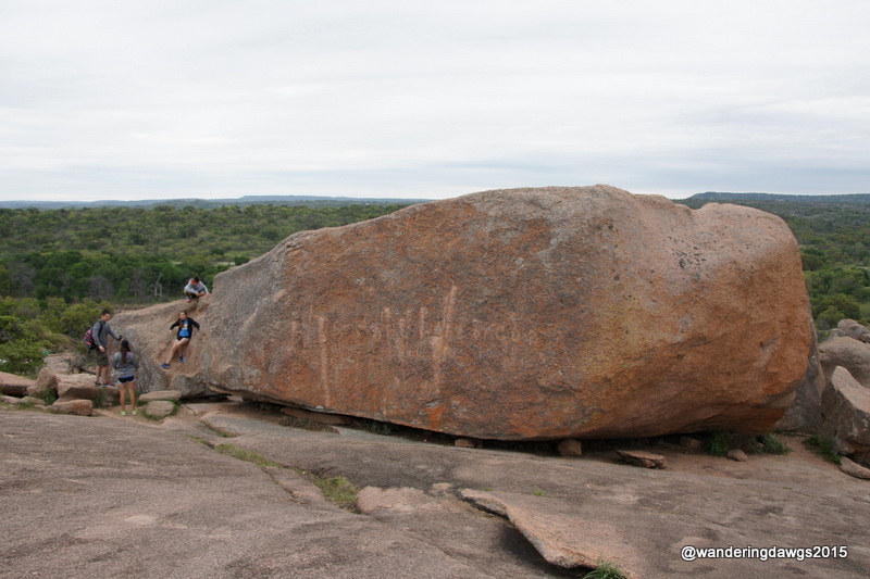
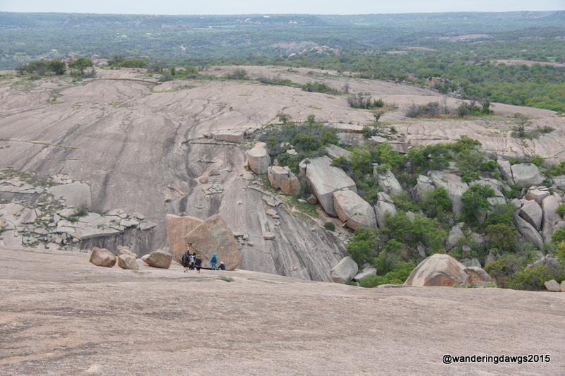
Enchanted Rock State Park is short drive south of Llano so on Saturday we set out early in the morning in hopes of beating the Easter weekend crowds. We arrived at the park entrance before 9:30 only to find a line of cars waiting to get in. It only took a few minutes to get our parking permit, park and head for the summit trail. Many families were out enjoying the climb to the top.
The highest point of Enchanted Rock 1,825 is feet above sea level. Climbing the Rock is like climbing the stairs of a 30- or 40-story building. My fitbit said I climbed 56 floors that day!
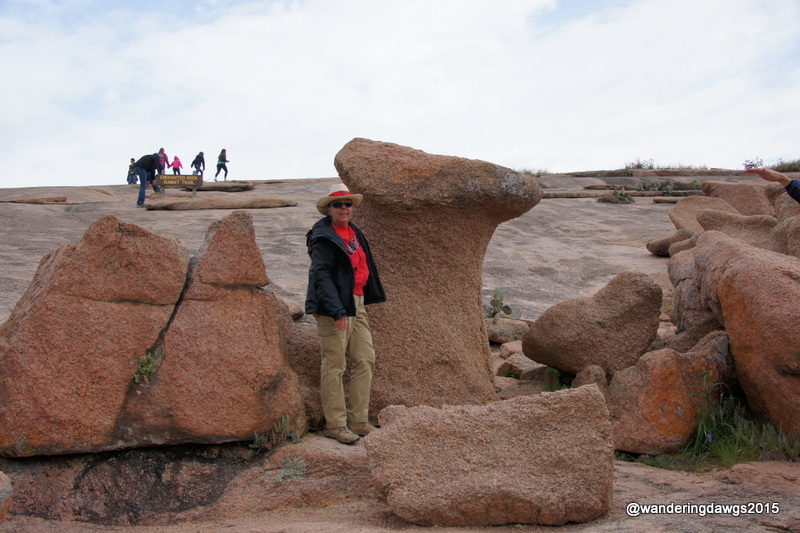
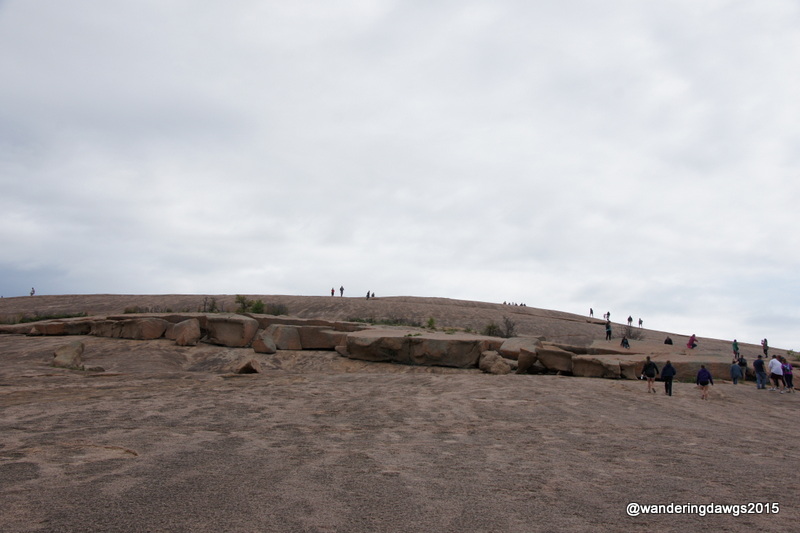
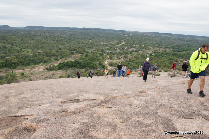
Enchanted RockWe hiked the Enchanted Rock Summit TrailThe camel on the way to the summit of Enchanted RockThe camel on the way to the summit of Enchanted RockThe trail was pretty steep as we got near the topAt the Summit of Enchanted RockView from the summit of Enchanted RockKids can’t resist climbing on the huge rocksView from the summit of Enchanted Rock
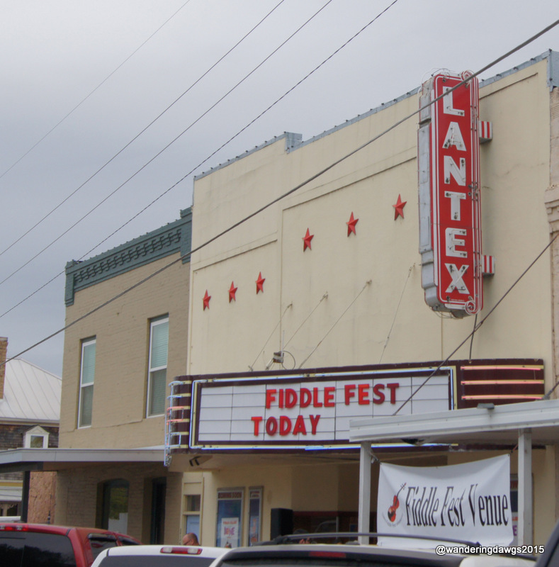
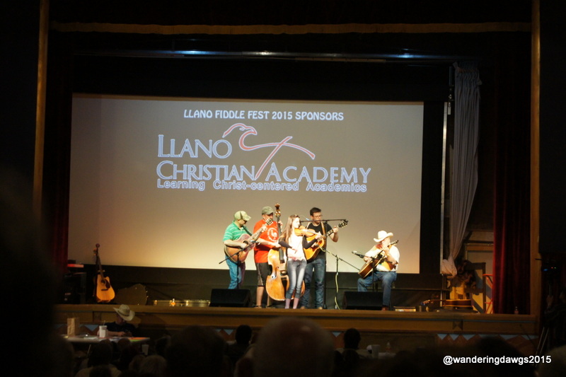
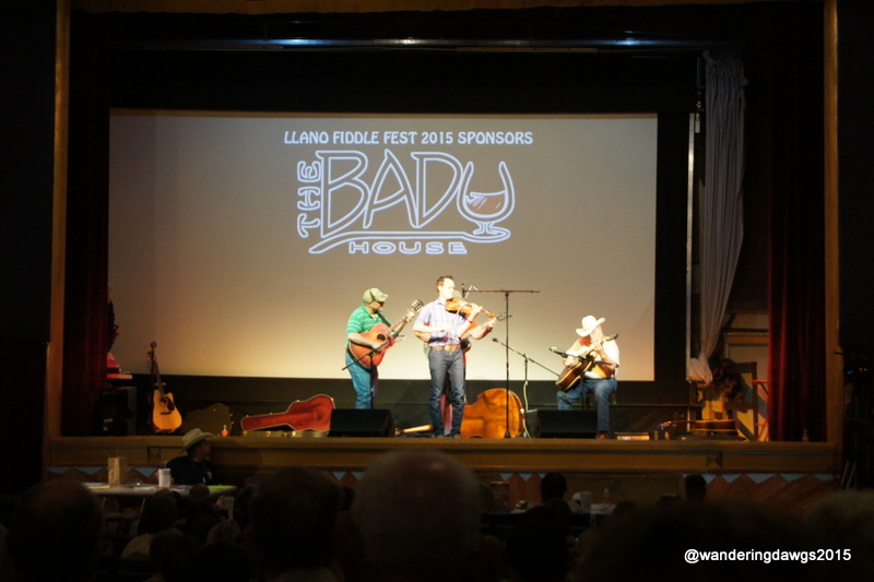
We had a great time at the Llano Fiddle Fest. After a picnic lunch at the bottom of Enchanted Rock we returned to Llano to go the LanTex Theater to hear some of the fiddlers in the 38th Llano Open Fiddle Contest. I don’t know anything about Texas Fiddling but I know I enjoyed all of the contestants we heard.
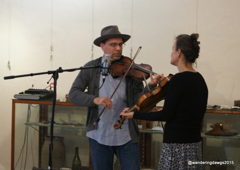
On Sunday morning we drove to the Llano Museum to hear some more fiddling and eat a Cowboy Breakfast put on by the Llano Historical Society. We got there as the ladies were starting to put everything away but they told us to come on into the kitchen for some biscuits and sausage gravy. The volunteers were so friendly and nice. I love small towns!
Spencer and Rains were playing old time fiddle tunes in one of the rooms in the museum. Tricia Spencer grew up in Kansas and learned to play from her grandparents. Howard Rains is a native Texas artist. We enjoyed listening to their music and bought one of their CD’s.
LanTex Theater was the venue for Llano Fiddle Fest Contest 20Llano Fiddle Fest 2015Llano Fiddle Fest 2015Spencer and Rains Easter morning at the Llano Museum
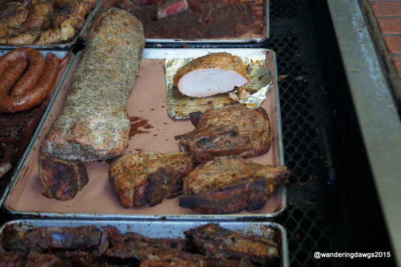
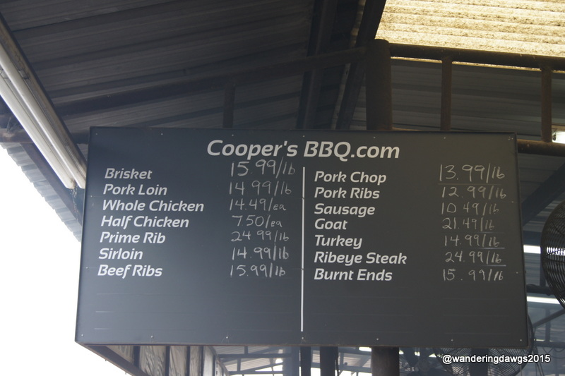
Saturday afternoon after climbing Enchanted Rock and listening to fiddling we returned to Cooper’s BBQ to get some take out for our Easter dinner on Sunday. The line was wrapped around the building but after a short wait we arrived at the pits to choose our meat right off the grill. We chose a chicken half, brisket and pork tenderloin. We got some beans, sauce, and jalepenos to go with it and were back at the campground to rest after our busy day.
Cooper’s BBQCooper’s BBQ
Llano River
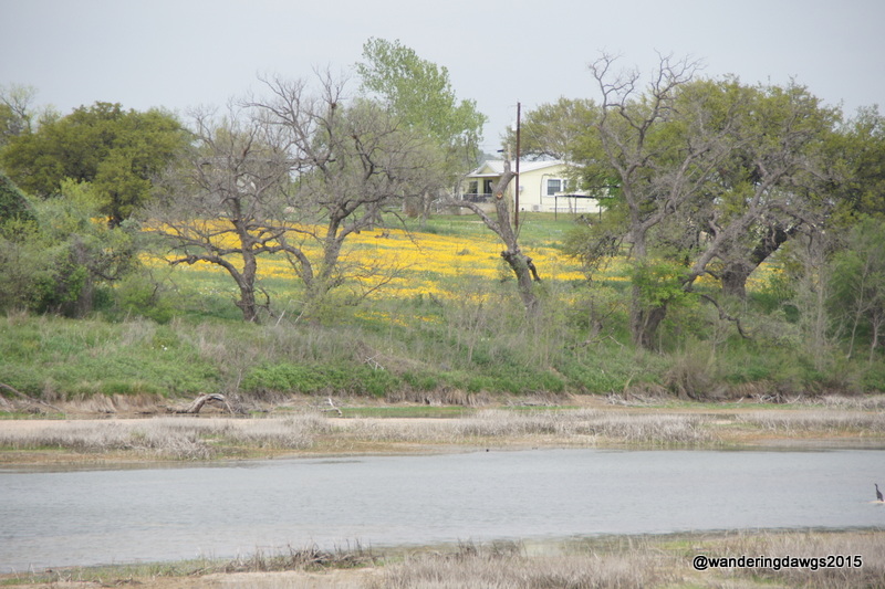
Riverway RV Park was our home while in Llano. This private park takes Passport America and Good Sam. All the sites are large pull through sites with full hookups, WiFi, and cable. There is a large clubhouse with kitchen, meeting room and a very nice laundry. The RV park is located on the Llano River only about a mile from downtown Llano. There is a short trail to the Llano River. Wildflowers were blooming beside the trail when we were there. Go here for my review of this park.


")
")
")
")