Day 54: Into the Denali Wilderness

Day 54: Monday, July 8, 2013. Denali RV Park and Motel to Teklanika River Campground, Denali National Park, Site 27. About 40 miles driven.

Denali Park Road is the only road in Denali National Park and Preserve. Private vehicles can drive the first 15 miles. Within those first 15 miles are the Visitor’s Center, the sled dog kennels, a campground, a science and learning center, scenic turnouts, and many hiking trails.

Travel beyond the first 15 miles is limited to the park buses and private vehicles going to and from Teklanika River Campground at mile marker 29.1. The campground has about 50 sites and a few of them are quite large. There is a three night minimum stay required and once we set up in our campsite we could not move our vehicle until the day we left. When we checked into the campground we received a camping pass along with a vehicle pass which we showed a park ranger at the Savage Creek checkpoint at the end of the 15 miles. She asked if we had filled our fresh water tank and had food. When we replied yes we were on our way into the wilderness area of Denali National Park.

The first 15 miles of the Denali Park Road is paved. The rest is dirt. The 90 mile road has several rest areas and scenic turnouts for the buses.

The wilderness area of Denali is just that.  Congress designated Denali to remain a mostly primitive area. There are no maintained trails except for around the Eielson visitor’s center. Hikers can hike wherever they want. There are a few campgrounds for tent camping that can only be reached by riding the bus. Bicycles are allowed and we saw a few cyclists.

After setting up camp we walked to the bus stop to wait for a bus so we could see some of the Denali Wilderness. The buses start near the entrance to the park where visitors can board for a tour. The 20 people waiting for the bus at our campground were all hoping to get the next bus. Sometimes the bus is full and riders have to wait for the next one. Most of the riders are hoping to see wildlife and the protocol is to shout “STOP” if anything is spotted. The driver will stop the bus and, if possible, position the bus so there is a good view of the wildlife. Our bus had scheduled stops at Teklanika River rest area, Polychrome overlook, Toklat River rest area, and Eielson Visitor’s Center. The rest areas have pit toilets and the Eielson visitor’s center has rest rooms. At each stop the driver announces when he will depart. Riders can stay longer at any location and catch another bus later. Hikers can catch a ride on a bus by standing on the side of the road and waving their arms.

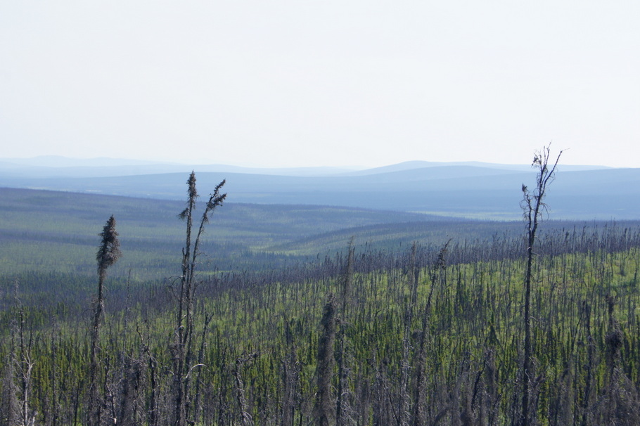
We rode the bus as far as the Eielson Visitor’s Center. Our two objectives were to see wildlife and hopefully Mt. McKinley. On a clear day the mountain can be seen from the Eielson visitor’s center. Unfortunately, it was not a clear day. We struck out pretty much on the wildlife sightings, too. There were several Caribou sightings and Dall sheep so high on the mountain they looked like white dots. No bears at all.

The rain started coming down as we returned to the campground. Our campsite was at the end of a row with trees and wildflowers surrounding us. The site next to us was empty and we felt like the only people there.

Day 51: Denali at last

Day 51: Friday, July 5, 2013. North Pole, Alaska to Denali. Denali RV Park and Motel, Site 5. 194 miles traveled.

With all our chores and shopping in Fairbanks completed it was time to continue our Alaskan adventure. We left North Pole behind and traveled the Parks Highway to our RV park 8 miles outside the entrance of Denali National Park. Our reservations at Teklanika River Camp inside the national park aren’t until Monday so we will be exploring different areas of the park until then.

We made it!
Denali at last

As soon as we were set up in our campsite we drove to Denali National Park. A quick stop at the Visitor’s Center to get our National Park Passport stamped and to purchase my Senior Pass or Geezer Pass as it is often called. I officially became a senior when I turned 62 a couple of weeks ago. The National Park Service offers a Senior Pass to those of us who have reached that ripe old age. For $10 you receive a lifetime pass which gets you into any national park or monument for free and a discount for camping in many of the federal campgrounds.

With that chore completed, we stopped at the bookstore to search for a guide book to the plants and animals of Denali so we’ll know what we are looking at.

It was finally time to go explore the park. In Denali, private vehicles are only allowed on the first 15 miles of the Denali Park Road. To travel beyond that point everyone must travel on a shuttle or tour bus. The only exception is campers going to Teklanika River Camp where we will be going on Monday. More about that later.

As we traveled along the highway marveling at the beauty around us we had to stop a few times when a shuttle bus in front of us stopped. If the shuttle bus stops there must be something good to see.

At the 15 mile mark we stopped at the Savage River overlook to enjoy the view and then turned around to make our way back to the park entrance. We were hoping to get a glimpse of Mt. McKinley. Like most days, clouds were covering the peaks. At one of the overlooks we got out binoculars and searched along with a couple from Texas and a couple from Toronto. Henry spotted the peaks above the clouds first. As he pointed out where to look the excitement grew among the crowd. One by one we heard “I see it!”.

On our way back out of the park, we stopped again as the shuttle bus in front of us stopped. A moose was right beside the road not bothered by us at all.

Mt. McKinley and two moose on our first visit to Denali! What a great introduction to the park!

We stopped at the Wilderness Access Area to find out information about what to do when we check in on Monday. The lady helping us was from Georgia. She told us we could go ahead and check in so we did. With all the necessary parking and shuttle passes in hand we headed back to our campground.

I’ve been waiting for an opportunity to make some crab stew with some of our Dungeness Crab from Haines. The weather here is windy and cold and it was a perfect night for stew. Out of this world delicious if I do say so myself.

Day 43: Going to North Pole

Day 43: Thursday, June 27, 2013. Tok, Alaska to North Pole, Alaska. Riverview RV Park Site 123. 200 miles traveled.

Despite the smoke from forest fires covering the road for much of the day, it was a good driving day on paved, mostly flat roads all day.

We had our first view of the Alaska Pipeline at the Tanana River.

A nice rest area along the shore of Birch Lake was a perfect place to stop for lunch.

Twenty-six miles south of Fairbanks the highway passes through Eielson Air Force Base. Signs posted announce no stopping and no photography. Seeing the runway beside the highway took me back to my childhood growing up as an Air Force brat.

I apologize for three posts at once. I am almost up to date!

Day 42: Back on Paved Roads

Day 42: Wednesday, June 26, 2013. Chicken, Alaska to Tok, Alaska. Tok RV Village, Site 709. 78 miles traveled.

A few more images of Chicken before we continue on our journey.

We passed through areas of burned trees from forest fires
We saw evidence of forest fires

Our journey continued on the Taylor highway. After a few miles we finally were back on pavement! We hit a few more spots with gravel before we turned back onto the Alaska Highway to Tok. In many places we could see evidence of forest fires.

After arriving in Tok we spent over an hour giving the truck and RV a much needed wash before setting up in our campsite. We were so happy to have grass and trees between the campsites!

Day 41: On Top of the World

Day 41: June 25, 2013. Dawson City, Yukon to Chicken, Alaska on Top of the World Highway. Chicken Gold Camp Site 5. 108 miles traveled in about 7 hours.

To get to Alaska from Dawson City, the shortest route is to travel across The Top of the World Highway on mostly gravel road with few guard rails and spectacular views.

Our journey began as we got in line for the ferry about 8:00. We watched the ferry make several trips across the river before it was our turn to board about 9:00.

Once we exited the ferry in West Dawson, we were on our way on the Top of the World Highway. It was originally called the Ridge Road because it was built on top of the ridge.

We crossed back into the United States at Poker Creek, the northernmost border crossing by land in North America

After that, the road was even worse than before! There is construction work on the American side. The road is very narrow in places and has very soft shoulders and no guardrails. After about 8 miles we turned onto the Taylor Highway which was the scariest part of the trip. Soft shoulders, narrow, and straight drop offs. The view of the valley below was supposed to be beautiful but I had to keep looking straight ahead!

We arrived in Chicken, Alaska and got the last electric site there. There are only three places in Chicken – Downtown Chicken, The Town of Chicken, and Chicken Gold Camp where we stayed. You can walk from one place to another. Each one has a campground, store, and restaurant. There’s a post office down the road a short distance. The mail plane only comes twice a week.