This week’s photo challenge from Amy asks us to show negative space. The negative space in a photo is the space surrounding the main subject in an image. This negative space can add a sense of emptiness, calm, peacefulness, or isolation.
In the photo above, the little dachshund is the main subject of this image. Our eye is drawn beyond the dog where we see he is running towards a flock of brown pelicans on a deserted beach.
In the next two photos, I felt the isolation of some very remote areas in the United States.
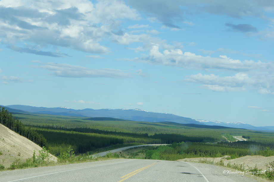
Driving through the Big Sky country of Montana toward the Bighorn MountainsOn this remote section of the Alaska Highway we were the only vehicle for miles
I like to use negative space to surround the main subject when taking closeup photos in the garden.
This week Tina has chosen “The Long and Winding Road” as our challenge. During our travels we have driven on so many long and winding roads I wasn’t sure which ones to include.
As I thought about how to approach this challenge, my mind kept going back to our 2013 RV trip to Alaska. There were many long and winding roads during our journey but I decided to focus on just one.
Exactly seven years ago today we were in Dawson Creek, British Columbia, Canada at the start of the Alaska Highway (also called the AlCan). Before returning home we would travel on every mile of this long and winding road.
The United States military began construction of the Alaska Highway in 1942 to provide an overland route to Alaska. The approximately 1400 mile road from Dawson Creek, BC to Delta Junction, Alaska was completed in 8 months and 12 days.
Mile Zero of the Alaska Highway! in Dawson Creek, BC
As you can see from the photo above, like many other travelers, we posed for a picture at the famous sign marking the beginning of the Alaska Highway. (The actual location of mile marker 0 is in downtown Dawson Creek, BC). There’s more about our stay in Dawson Creek at Mile Zero of the Alaska Highway.
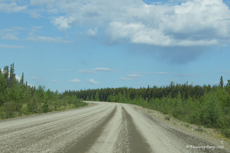
Part of the road was paved, part was gravel, and part was under construction. There were frost heaves and pot holes, some marked with signs and some not. Sometimes we would go for miles without seeing another vehicle. We stopped at pull outs for breaks and never had a problem finding campgrounds or diesel fuel.
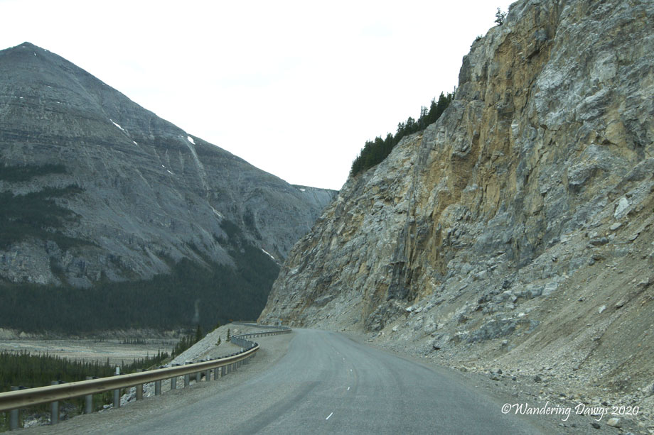
Gravel section of the Alaska Highway in the Yukon
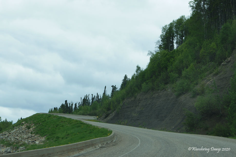
The Alaska HIghway in the Yukon
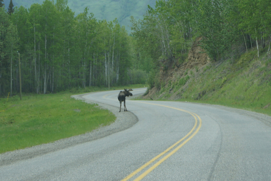
We drove slowly and enjoyed the wildlife and magnificent views.
Moose on the Alaska Highway
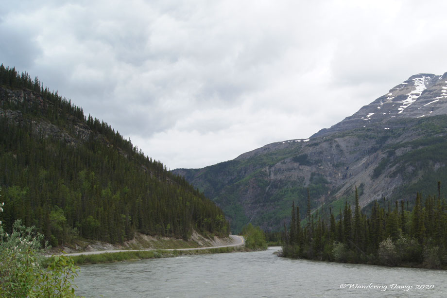
Alaska Highway
Alaska Highway
As I worked on this post I thought of how empty this road must be this summer with the U.S./Canadian border still closed. I remember the campgrounds, restaurants, and stores we stopped at along the way in Canada and Alaska. These businesses have a short season and depend on summer travelers to make it through the rest of the year. I hope that they will be able to make it until next year when hopefully people will be traveling again.
I am so grateful we made this trip when we did. I still dream of returning to Alaska. Next time we will not be towing our fifth wheel along the Alaska Highway. Instead, I see airplanes and ships in our future.
I recently posted our Favorite Alaska Memories so now it is time to post our favorite memories of traveling through Alberta, British Columbia, and the Yukon Territory. We spent 23 nights in Canada and enjoyed the beautiful scenery, abundant wildlife, and friendly Canadian people.
We started our travels in Canada by spending almost a week in Alberta in Banff National Park and Jasper National Park.
Elk by the side of the road in Banff National Park
Elk on the Bow Valley Parkway
Lake Louise
Moraine Lake
Peyto Lake is a much deeper turquoise than the other lakes along the parkway
Elk near our campsite in Jasper
We saw lots of wildlife as we drove through British Columbia on the Alaska Highway before arriving in Alaska for the first time.
Mile Zero of the Alaska Highway! in Dawson Creek, BC
Stone Sheep on the Alaska Highway
Caribou on the Alaska Highway
Moose on the Alaska Highway
Bison herd with calves near Liard River Hotsprings
After a week in Alaska we drove through Canada to Dawson City, Yukon and across the Top of the World Highway before returning to Alaska.
Black Bear beside the road in British Columbia
Panning for gold in Dawson City, Yukon
View on the Top of the World Highway
Our journey back to the lower 48 took us along the Cassier Highway through British Columbia.
Sunrise at Burwash Landing, Yukon Territory
Salmon Glacier in British Columbia about 17 miles past Hyder, Alaska
Bear Glacier near Stewart, BC
For a map of our entire journey be sure to check out Our Route. And for a list of all the campgrounds where we stayed check out our Campground List.
Day 30: Friday, June 14, 2013. Liard Hotsprings, BC to Watson Lake, Yukon Territory. Downtown RV Park Site 2. 190 miles traveled.
Watson Lake, Yukon Territory is the site of the Sign Post Forest. The forest was started by an American soldier who was working on the Alaska Highway in 1942. He erected a sign pointing to his hometown of Danville, Illinois. Today, it is filled with signs, now including ours.
Welcome to the Yukon Territory
The Sign Post Forest in Watson Lake, Yukon
Signpost Forest in Watson Lake, Yukon
Signpost Forest in Watson Lake, Yukon
Other Bulldogs have been here!
Sign Post Forest
Our friends, John and Sherry, erected this yellow sign a few years ago
More Georgia Bulldogs
Next to our sign in the signpost forest in Watson Lake, Yukon
We experienced sticker shock at the liquor store in Watson Lake when we paid $13 for a six pack of Canadian beer. The grocery store prices were sky high, too. But, even so, we enjoyed our visit.
After all our planning and traveling we feel like we are ready for anything.
Henry is loaded for bear with his dirty truck, trusty guard dog and $13 six pack of Canadian beer. Note to Lenoard: Bud Light is the same price.